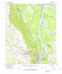
1961 Map of Latour
USGS Topo · Published 1965About this map
Helena and West Helena sit at the southern terminus of Crowley’s Ridge, where the highland terrain meets the alluvial plain of the Mississippi River. This 1961 field-checked map illustrates a landscape shaped by hydrology and industrial transit, featuring the complex meandering of the St Francis River and its numerous bends, including Jeffersonville Bend and Egg Bar Bend. The Missouri Pacific railroad lines anchor the regional transport network, connecting rural settlements like Lexa and LaGrange to the Mississippi riverfront.
Find a feature on this map
109 named features on this map. Tap any name to fly to it.
Don’t see what you’re looking for? This feature index may not catch every label — zoom into the map to look around manually.
Map Details
Editions of this 1961 Latour Map
2 editions found
Other maps of this area

1908 · Lula
USGS Topo · 1:24,000

1908 · Dundee
USGS Topo · 1:24,000

1908 · Moon Lake
USGS Topo · 1:24,000

1910 · Dundee
USGS Topo · 1:31,680

1912 · Moon Lake
USGS Topo · 1:31,680

1912 · Lula
USGS Topo · 1:31,680

1931 · Horseshoe Lake
USGS Topo · 1:62,500

1932 · Marks
USGS Topo · 1:48,000

1935 · Marks
USGS Topo · 1:62,500

1939 · Clayton
USGS Topo · 1:62,500