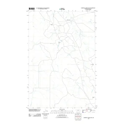
2011 Map of Lawrence Creek East
USGS Topo · Published 2011About this map
The Cabin Creek Oil Field and surrounding energy infrastructure define this part of Fallon County, Montana, during the early 21st century. The map illustrates a landscape shaped by petroleum extraction, featuring the South Wills Creek Oil Field and the Monarch Oil Field situated among the drainage basins of the Yellowstone River tributary system. Water management is central to the area's geography, evidenced by the Leo Number 2 Dam and a network of seasonal watercourses including Lawrence Creek, Dry Fork Creek, and the Middle Fork Cabin Creek. Local transit and access to these remote resource fields are provided by arterial routes such as Plevna Rd and Anticline Rd, which follow the contours of the high plains terrain. This document captures the industrial footprint of eastern Montana's oil economy integrated into a predominantly rural, hydrological landscape.
Find a feature on this map
13 named features on this map. Tap any name to fly to it.
Don’t see what you’re looking for? This feature index may not catch every label — zoom into the map to look around manually.
Map Details
Editions of this 2011 Lawrence Creek East Map
This is the sole edition of this map. No revisions or reprints were ever made.
Other maps of this area

1953 · Miles City
USGS Topo · 1:250,000

1957 · Miles City
USGS Topo · 1:250,000

1958 · Miles City
USGS Topo · 1:250,000

1981 · Baker
USGS Topo · 1:100,000

1981 · Baker NE
USGS Topo · 1:24,000

1981 · Lawrence Creek East
USGS Topo · 1:24,000

1981 · Lawrence Creek West
USGS Topo · 1:24,000

1981 · Baker NW
USGS Topo · 1:24,000

1981 · Ayer Spring NE
USGS Topo · 1:24,000
1981 · Plevna
USGS Topo · 1:24,000