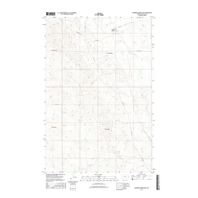
2017 Map of Lawrence Creek East
USGS Topo · Published 2017About this map
Cabin Creek and its surrounding drainages define the landscape of Fallon County in this western Montana survey. The terrain is deeply etched by a network of seasonal watercourses, including Wills Cr, Middle Fork Cabin Cr, and Lawrence Cr. The presence of Gas Plant Rd and Anticline Rd highlights the region's connection to the local energy industry, reflecting the underlying geology of the Cedar Creek Anticline. Navigation across these townships relies on a grid of gravel and dirt routes such as Plevna Rd N and Cap Rock Rd, which weave through the sectioned land parcels typical of the American West. This map preserves the 2017 configuration of rural infrastructure and natural drainage patterns, essential for understanding the modern industrial and agricultural footprint in this corner of the state.
Find a feature on this map
16 named features on this map. Tap any name to fly to it.
Don’t see what you’re looking for? This feature index may not catch every label — zoom into the map to look around manually.
Map Details
Editions of this 2017 Lawrence Creek East Map
This is the sole edition of this map. No revisions or reprints were ever made.
Other maps of this area

1953 · Miles City
USGS Topo · 1:250,000

1957 · Miles City
USGS Topo · 1:250,000

1958 · Miles City
USGS Topo · 1:250,000

1981 · Baker
USGS Topo · 1:100,000

1981 · Baker NE
USGS Topo · 1:24,000

1981 · Lawrence Creek East
USGS Topo · 1:24,000

1981 · Lawrence Creek West
USGS Topo · 1:24,000

1981 · Baker NW
USGS Topo · 1:24,000

1981 · Ayer Spring NE
USGS Topo · 1:24,000
1981 · Plevna
USGS Topo · 1:24,000