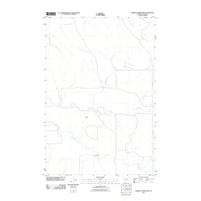
2011 Map of Lawrence Creek West
USGS Topo · Published 2011About this map
Pennel Creek and its many meandering tributaries define this portion of Fallon County, Montana, illustrating a landscape primarily shaped by drainage patterns and water management. The terrain is marked by intermittent waterways such as Dry Fork Creek and Cow Creek, which feed into the larger regional network. Human intervention in this arid environment is evident through local infrastructure like Ohlrick Dam and the Oscar Number 6 Dam, structures essential for water retention in a ranching-heavy region. Navigation through this corner of the state relies on a sparse grid of rural routes, including Road 626 and N Plevna Rd, which connect isolated sections of the plains. This 2011 survey captures the area before significant modern development, focusing on the fundamental relationship between the high plains hydrology and the early 21st-century rural road network.
Find a feature on this map
9 named features on this map. Tap any name to fly to it.
Don’t see what you’re looking for? This feature index may not catch every label — zoom into the map to look around manually.
Map Details
Editions of this 2011 Lawrence Creek West Map
This is the sole edition of this map. No revisions or reprints were ever made.
Other maps of this area

1953 · Miles City
USGS Topo · 1:250,000

1957 · Miles City
USGS Topo · 1:250,000

1958 · Miles City
USGS Topo · 1:250,000

1981 · Baker
USGS Topo · 1:100,000

1981 · Lawrence Creek East
USGS Topo · 1:24,000

1981 · Lawrence Creek West
USGS Topo · 1:24,000

1981 · Baker NW
USGS Topo · 1:24,000

1981 · Dorothy Draw
USGS Topo · 1:24,000

1981 · Ayer Spring NE
USGS Topo · 1:24,000

1981 · Ayer Spring
USGS Topo · 1:24,000