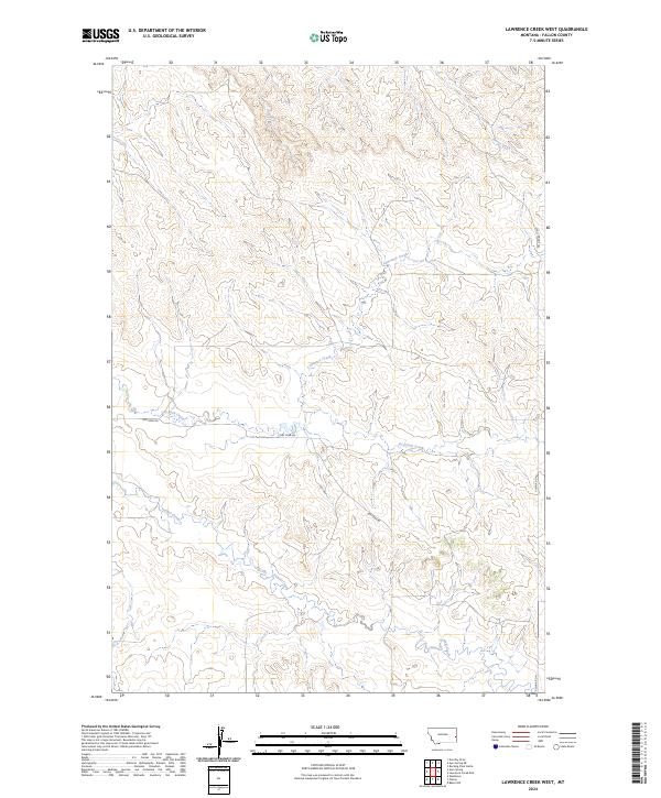
2024 Map of Lawrence Creek West
USGS Topo · Published 2024About this map
Pennel Creek and its complex network of seasonal tributaries define this expansive section of Fallon County, Montana. The landscape is characterized by a dense system of coulees and ridges, where several key waterways such as Dry Fork Creek and Horse Creek have carved out a rugged topography typical of the high plains. Human presence is marked by a handful of section-line roads and trails, including Plevna Rd N and Dry Fork Rd, which facilitate movement through the townships of t9n r57e and t10n r57e. The map illustrates the classic western land-grid system, where the township and range lines overlay the natural flow of Cow Creek and Lawrence Creek, highlighting the tension between geometric settlement patterns and the winding path of prairie drainage systems.
Find a feature on this map
12 named features on this map. Tap any name to fly to it.
Don’t see what you’re looking for? This feature index may not catch every label — zoom into the map to look around manually.
Map Details
Editions of this 2024 Lawrence Creek West Map
This is the sole edition of this map. No revisions or reprints were ever made.
Other maps of this area

1953 · Miles City
USGS Topo · 1:250,000

1957 · Miles City
USGS Topo · 1:250,000

1958 · Miles City
USGS Topo · 1:250,000

1981 · Baker
USGS Topo · 1:100,000

1981 · Lawrence Creek East
USGS Topo · 1:24,000

1981 · Lawrence Creek West
USGS Topo · 1:24,000

1981 · Baker NW
USGS Topo · 1:24,000

1981 · Dorothy Draw
USGS Topo · 1:24,000

1981 · Ayer Spring NE
USGS Topo · 1:24,000

1981 · Ayer Spring
USGS Topo · 1:24,000