
1956 Map of Lawrence
USGS Topo · Published 1967About this map
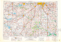
Forbes AFB and Sunflower Ordnance Works stand as prominent markers of the Cold War military landscape in this mid-century survey of eastern Kansas and western Missouri. The mapping captures a period of significant hydraulic engineering, showing the Pomona Reservoir and John Redmond Res altering the natural flow of the Marais des Cygnes River and Neosho River. The region’s transportation evolution is evident as newly constructed corridors like Interstate 70 begin to parallel the historic routes of the Atchison Topeka and Santa Fe RR and Missouri Pacific RR.
Find a feature on this map
107 named features on this map. Tap any name to fly to it.
Don’t see what you’re looking for? This feature index may not catch every label — zoom into the map to look around manually.
Map Details
Editions of this 1956 Lawrence Map
4 editions found
Other maps of this area

1884 · Fort Scott
USGS Topo · 1:125,000

1885 · Eskridge
USGS Topo · 1:125,000

1885 · Burlington
USGS Topo · 1:125,000

1885 · Eureka
USGS Topo · 1:125,000

1885 · Garnett
USGS Topo · 1:125,000

1885 · Warrensburg
USGS Topo · 1:125,000

1885 · Lawrence
USGS Topo · 1:125,000

1886 · Nevada
USGS Topo · 1:125,000

1886 · Fredonia
USGS Topo · 1:125,000

1886 · Stockton
USGS Topo · 1:125,000