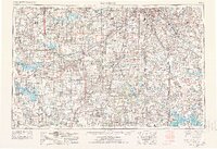
1956 Map of Lawrence
USGS Topo · Published 1976About this map
The Kansas River corridor anchors this regional survey, connecting the growing urban centers of Topeka and Lawrence with the western reaches of the Kansas City metropolitan area. Compiled in the mid-1950s and revised in 1974, the landscape reveals a transition from industrial and military activity to modern water management. Significant infrastructure projects like the Clinton Lake and Pomona Lake reservoirs appear alongside major Cold War-era installations, including Forbes AFB and the Sunflower Ordnance Works.
Find a feature on this map
121 named features on this map. Tap any name to fly to it.
Don’t see what you’re looking for? This feature index may not catch every label — zoom into the map to look around manually.
Map Details
Editions of this 1956 Lawrence Map
4 editions found

Other maps of this area

1884 · Fort Scott
USGS Topo · 1:125,000

1885 · Eskridge
USGS Topo · 1:125,000

1885 · Burlington
USGS Topo · 1:125,000

1885 · Eureka
USGS Topo · 1:125,000

1885 · Garnett
USGS Topo · 1:125,000

1885 · Warrensburg
USGS Topo · 1:125,000

1885 · Lawrence
USGS Topo · 1:125,000

1886 · Nevada
USGS Topo · 1:125,000

1886 · Fredonia
USGS Topo · 1:125,000

1886 · Stockton
USGS Topo · 1:125,000