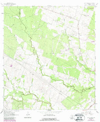
1963 Map of Lazy F Ranch
USGS Topo · Published 1987About this map
Blanco Creek winds through this South Texas landscape where the boundaries of Goliad and Bee counties meet. The area is defined by a ranching and energy-based economy, evidenced by the eponymous Lazy F Ranch and the industrial footprint of the Dallas Husky Gas Field. This 1963 survey captures the intersection of traditional land use and mid-century military infrastructure, most notably the Goliad Naval Auxiliary Landing Field occupying the northeast corner.
Find a feature on this map
22 named features on this map. Tap any name to fly to it.
Don’t see what you’re looking for? This feature index may not catch every label — zoom into the map to look around manually.
Map Details
Editions of this 1963 Lazy F Ranch Map
Other maps of this area

1936 · Pettus
USGS Topo · 1:62,500

1953 · Beeville
USGS Topo · 1:250,000

1954 · Skidmore
USGS Topo · 1:62,500

1954 · Fleming
USGS Topo · 1:62,500

1956 · Beeville
USGS Topo · 1:250,000

1956 · Pettus
USGS Topo · 1:62,500

1960 · Beeville
USGS Topo · 1:250,000
1963 · Tuleta
USGS Topo · 1:24,000
1963 · Tulsita
USGS Topo · 1:24,000

1963 · Lazy F Ranch
USGS Topo · 1:24,000