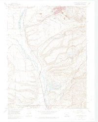
1969 Map of Leadville South
USGS Topo · Published 1974About this map
The Arkansas River and the Denver and Rio Grande Western railroad corridor define the valley floor in this study of high-altitude industry and settlement. The southern reaches of Leadville give way to specialized company landscapes like Stringtown and the cluster of mining operations on Carbonate Hill and Iron Hill. Heavy mineral extraction is evident through the extensive system of gulches, including California Gulch and Stray Horse Gulch, which are lined with heritage sites like the Adelaide (Site) and the Resurrection Mill (Site). Large-scale infrastructure such as Tailings Ponds, the Malta Substa, and the County Airport reflects the mid-century industrial footprint. On the valley's western edge, the San Isabel National Forest provides a sharp transition from the engineered mining districts to the more natural drainages of Halfmoon Creek and the Mt Massive Lakes.
Find a feature on this map
63 named features on this map. Tap any name to fly to it.
Don’t see what you’re looking for? This feature index may not catch every label — zoom into the map to look around manually.
Map Details
Editions of this 1969 Leadville South Map
4 editions found
Other maps of this area

1889 · Leadville
USGS Topo · 1:125,000

1891 · Leadville
USGS Topo · 1:125,000

1934 · Climax
USGS Topo · 1:48,000

1935 · Mount Elbert
USGS Topo · 1:62,500

1938 · Mt. Lincoln
USGS Topo · 1:48,000

1938 · Mount Elbert
USGS Topo · 1:62,500

1939 · Mount Elbert
USGS Topo · 1:62,500

1942 · Leadville
USGS Topo · 1:125,000

1945 · Mount Lincoln
USGS Topo · 1:62,500

1949 · Holy Cross
USGS Topo · 1:62,500