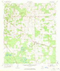
1958 Map of Lee
USGS Topo · Published 1971About this map
The town of Lee and the small settlement of West Farm serve as the primary hubs in this Madison County survey. The landscape is defined by the Seaboard Air Line railroad, which runs through the center of the region, passing near the Jr High Sch and Stonewall Cem. This era shows a community rooted in local institutions, evidenced by the presence of several country churches such as Macedonia Ch, Mt Olive Ch, and Corinth Ch.
Find a feature on this map
27 named features on this map. Tap any name to fly to it.
Don’t see what you’re looking for? This feature index may not catch every label — zoom into the map to look around manually.
Map Details
Editions of this 1958 Lee Map
3 editions found
Other maps of this area

1954 · Valdosta
USGS Topo · 1:250,000

1956 · Octahatchee
USGS Topo · 1:24,000

1958 · Valdosta
USGS Topo · 1:250,000

1958 · Madison SW
USGS Topo · 1:24,000

1958 · Madison SE
USGS Topo · 1:24,000

1958 · Lee
USGS Topo · 1:24,000

1959 · Valdosta
USGS Topo · 1:250,000

1959 · Madison
USGS Topo · 1:24,000

1959 · Ellaville
USGS Topo · 1:24,000

1959 · Falmouth
USGS Topo · 1:24,000