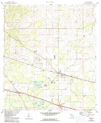
1958 Map of Lee
USGS Topo · Published 1993About this map
Highland karst topography and scattered agricultural settlements define this portion of Madison County. The community of Lee sits at the heart of the map, organized around the railway and central service buildings like the Jr High Sch. The landscape is heavily marked by limestone depressions and basins, ranging from the prominent Lee Sink and Campbell Sink to a network of water bodies including Riggins Lake, Booze Lake, and Cypress Pond. These natural reservoirs and sinks are interspersed with numerous small church communities and burial grounds, such as Mt Olive Ch and Stonewall Cem, reflecting the rural social structure of northern Florida. The Base Line serves as a primary east-west surveying axis, cutting through the wooded and marshy terrain near West Farm and Welch. Flowing through the southern portion, Norton Creek drains several smaller ponds, illustrating the complex hydrology of the region.
Find a feature on this map
28 named features on this map. Tap any name to fly to it.
Don’t see what you’re looking for? This feature index may not catch every label — zoom into the map to look around manually.
Map Details
Editions of this 1958 Lee Map
3 editions found
Other maps of this area

1954 · Valdosta
USGS Topo · 1:250,000

1956 · Octahatchee
USGS Topo · 1:24,000

1958 · Valdosta
USGS Topo · 1:250,000

1958 · Madison SW
USGS Topo · 1:24,000

1958 · Madison SE
USGS Topo · 1:24,000

1958 · Lee
USGS Topo · 1:24,000

1959 · Valdosta
USGS Topo · 1:250,000

1959 · Madison
USGS Topo · 1:24,000

1959 · Ellaville
USGS Topo · 1:24,000

1959 · Falmouth
USGS Topo · 1:24,000