
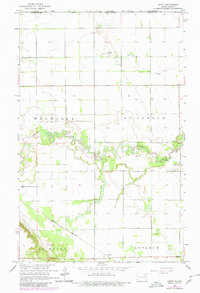
1964 Map of Leroy
USGS Topo · Published 1965About this map
The Pembina River winds in deep, wooded loops across this borderland landscape, defining the topography of the Lisgar District in the mid-1960s. The small settlement of Leroy serves as a local focal point near the river's southern banks, anchored by St Joseph church and the adjacent St Joseph Cem. The map reveals a highly structured agricultural grid, punctuated by townships such as Walhalla, St Joseph, Lamoure, and Advance.
Find a feature on this map
14 named features on this map. Tap any name to fly to it.
Don’t see what you’re looking for? This feature index may not catch every label — zoom into the map to look around manually.
Map Details
Editions of this 1964 Leroy Map
2 editions found
Other maps of this area

1918 · Walhalla
USGS Topo · 1:62,500

1939 · Cavalier
USGS Topo · 1:62,500

1941 · Cavalier
USGS Topo · 1:62,500

1943 · Walhalla
USGS Topo · 1:62,500

1952 · Thief River Falls
USGS Topo · 1:250,000

1956 · Thief River Falls
USGS Topo · 1:250,000

1957 · Thief River Falls
USGS Topo · 1:250,000

1964 · Hallson
USGS Topo · 1:24,000

1964 · Walhalla
USGS Topo · 1:24,000
1964 · Backoo
USGS Topo · 1:24,000