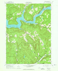
1965 Map of Lewbeach
USGS Topo · Published 1973About this map
The Pepacton Reservoir dominates this landscape, its creation having fundamentally altered the topography of the East Branch Delaware River valley. This mid-1960s record shows the extensive NYC Water Supply Reservation Boundary and infrastructure associated with the city's watershed, including the Shavertown Bridge and the path of the Delaware Aqueduct. High ridges like Middle Mountain and Mary Smith Hill surround the water, while the small settlement of Lewbeach sits at the southern edge near the Beaver Kill.
Find a feature on this map
54 named features on this map. Tap any name to fly to it.
Don’t see what you’re looking for? This feature index may not catch every label — zoom into the map to look around manually.
Map Details
Editions of this 1965 Lewbeach Map
4 editions found
Other maps of this area

1901 · Margaretville
USGS Topo · 1:62,500

1904 · Margaretville
USGS Topo · 1:62,500

1910 · Neversink
USGS Topo · 1:62,500

1921 · Livingston Manor
USGS Topo · 1:62,500

1922 · Andes
USGS Topo · 1:62,500

1923 · Livingston Manor
USGS Topo · 1:62,500

1924 · Andes
USGS Topo · 1:62,500

1942 · Neversink
USGS Topo · 1:62,500

1943 · Monticello
USGS Topo · 1:125,000

1944 · Livingston Manor
USGS Topo · 1:62,500