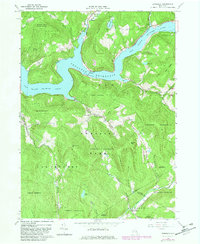
1965 Map of Lewbeach
USGS Topo · Published 1983About this map
Pepacton Reservoir dominates the northern landscape of this region, held by the Shavertown Bridge at an elevation of 1280 feet. This 1965 survey, updated in the early 1980s, captures the flooded valley of the East Branch Delaware River where earlier traces of settlement remain visible through the Pepacton Cem and Shavertown Ch. The terrain is characterized by steep ridges and narrow hollows, including Middle Mountain and Beech Hill, which are largely preserved as part of Catskill Park.
Find a feature on this map
49 named features on this map. Tap any name to fly to it.
Don’t see what you’re looking for? This feature index may not catch every label — zoom into the map to look around manually.
Map Details
Editions of this 1965 Lewbeach Map
4 editions found
Other maps of this area

1901 · Margaretville
USGS Topo · 1:62,500

1904 · Margaretville
USGS Topo · 1:62,500

1910 · Neversink
USGS Topo · 1:62,500

1921 · Livingston Manor
USGS Topo · 1:62,500

1922 · Andes
USGS Topo · 1:62,500

1923 · Livingston Manor
USGS Topo · 1:62,500

1924 · Andes
USGS Topo · 1:62,500

1942 · Neversink
USGS Topo · 1:62,500

1943 · Monticello
USGS Topo · 1:125,000

1944 · Livingston Manor
USGS Topo · 1:62,500