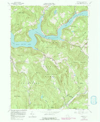
1965 Map of Lewbeach
USGS Topo · Published 1992About this map
The Pepacton Reservoir dominates this Catskill landscape, its winding shoreline following the flooded valley of the East Branch Delaware River. This survey, updated with revisions from the early 1980s, captures the area after the reservoir's creation forever changed the geography of the town of Colchester. The hamlet of Shavertown remains as a focal point near the Shavertown Bridge, while Pepacton Cem serves as a reminder of the community displaced by the rising waters.
Find a feature on this map
46 named features on this map. Tap any name to fly to it.
Don’t see what you’re looking for? This feature index may not catch every label — zoom into the map to look around manually.
Map Details
Editions of this 1965 Lewbeach Map
4 editions found
Other maps of this area

1901 · Margaretville
USGS Topo · 1:62,500

1904 · Margaretville
USGS Topo · 1:62,500

1910 · Neversink
USGS Topo · 1:62,500

1921 · Livingston Manor
USGS Topo · 1:62,500

1922 · Andes
USGS Topo · 1:62,500

1923 · Livingston Manor
USGS Topo · 1:62,500

1924 · Andes
USGS Topo · 1:62,500

1942 · Neversink
USGS Topo · 1:62,500

1943 · Monticello
USGS Topo · 1:125,000

1944 · Livingston Manor
USGS Topo · 1:62,500