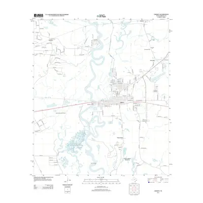
2013 Map of Liberty
USGS Topo · Published 2013About this map
The Trinity River snakes through the center of this landscape, its deep oxbows and secondary channels creating a complex wetland environment marked by features like Horseshoe Lake, Twin Lake, and Josie Lake. The city of Liberty serves as the regional hub, situated just east of the State Highway 3 Bridge. To the south, the industrial character of the region is evident at the South Liberty Oil Field near South Liberty, while the Negros Liberty Settlement and Atascosito point to older layers of community development and local heritage.
Find a feature on this map
152 named features on this map. Tap any name to fly to it.
Don’t see what you’re looking for? This feature index may not catch every label — zoom into the map to look around manually.
Map Details
Editions of this 2013 Liberty Map
This is the sole edition of this map. No revisions or reprints were ever made.
Other maps of this area

1943 · Liberty
USGS Topo · 1:125,000

1950 · Houston
USGS Topo · 1:250,000

1954 · Beaumont
USGS Topo · 1:250,000

1955 · Daisetta
USGS Topo · 1:62,500

1955 · Liberty
USGS Topo · 1:62,500

1956 · Houston
USGS Topo · 1:250,000

1957 · Beaumont
USGS Topo · 1:250,000

1961 · Shiloh
USGS Topo · 1:24,000
1961 · Sheeks
USGS Topo · 1:24,000
1961 · Moss Bluff
USGS Topo · 1:24,000