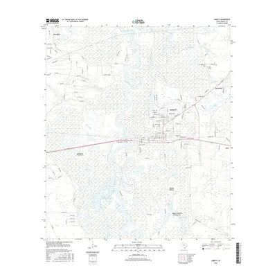
2016 Map of Liberty
USGS Topo · Published 2016About this map
The Trinity River dominates this landscape of the Texas Coastal Plain, winding through a complex network of bayous, lakes, and marshes. Notable for local history is the presence of Negros Liberty Settlement in the south, alongside established communities like Liberty, South Liberty, and Atascosito. The river's influence is clear in features like River Boat Bend, Snag Lake, and Horse Shoe Bend Bayou, illustrating a dynamic riparian environment where land and water frequently overlap.
Find a feature on this map
136 named features on this map. Tap any name to fly to it.
Don’t see what you’re looking for? This feature index may not catch every label — zoom into the map to look around manually.
Map Details
Editions of this 2016 Liberty Map
This is the sole edition of this map. No revisions or reprints were ever made.
Other maps of this area

1943 · Liberty
USGS Topo · 1:125,000

1950 · Houston
USGS Topo · 1:250,000

1954 · Beaumont
USGS Topo · 1:250,000

1955 · Daisetta
USGS Topo · 1:62,500

1955 · Liberty
USGS Topo · 1:62,500

1956 · Houston
USGS Topo · 1:250,000

1957 · Beaumont
USGS Topo · 1:250,000

1961 · Shiloh
USGS Topo · 1:24,000
1961 · Sheeks
USGS Topo · 1:24,000
1961 · Moss Bluff
USGS Topo · 1:24,000