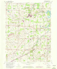
1960 Map of Limaville
USGS Topo · Published 1972About this map
Limaville sits at the intersection of a landscape defined by its early township boundaries and water resources, straddling the line between Randolph and Atwater in the north and Lexington and Marlboro below. This survey captures a rural landscape in transition, where legacy features like the Quaker Hill Cem and St Pauls Cem reflect deep-rooted local heritage alongside mid-century institutional developments such as the Molly Stark Hospital. The region is drained by Deer Creek, Beech Creek, and Nimishillen Creek, which carved the valleys that dictated the placement of early settlements and roads. The presence of the Penn Central rail line running through Alliance and Maximo underscores the importance of the railroad corridor to the local economy, while the sprawling Tannenhauf Golf Course and several campgrounds suggest an increasing shift toward recreational land use in the post-war era.
Find a feature on this map
60 named features on this map. Tap any name to fly to it.
Don’t see what you’re looking for? This feature index may not catch every label — zoom into the map to look around manually.
Map Details
Editions of this 1960 Limaville Map
4 editions found
Other maps of this area

1901 · Canton
USGS Topo · 1:62,500

1903 · Canton
USGS Topo · 1:62,500

1906 · Kent
USGS Topo · 1:62,500

1906 · Ravenna
USGS Topo · 1:62,500

1908 · Ravenna
USGS Topo · 1:62,500

1909 · Alliance
USGS Topo · 1:62,500

1950 · Cleveland
USGS Topo · 1:250,000

1951 · Canton
USGS Topo · 1:250,000

1952 · Alliance
USGS Topo · 1:24,000

1953 · Canton
USGS Topo · 1:250,000