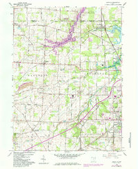
1960 Map of Limaville
USGS Topo · Published 1984About this map
Walborn Reservoir dominates the northern landscape of this Stark County region, its waters backing up into the Deer Creek valley and stretching across the Portage Co Stark Co line. The 1960 survey, updated in the early 1980s, reveals a mix of established agricultural settlements and expanding suburban infrastructure. Significant institutional landmarks include the Church of Peace Monastery and the Molly Stark Hospital near the southern boundary.
Find a feature on this map
61 named features on this map. Tap any name to fly to it.
Don’t see what you’re looking for? This feature index may not catch every label — zoom into the map to look around manually.
Map Details
Editions of this 1960 Limaville Map
4 editions found
Other maps of this area

1901 · Canton
USGS Topo · 1:62,500

1903 · Canton
USGS Topo · 1:62,500

1906 · Kent
USGS Topo · 1:62,500

1906 · Ravenna
USGS Topo · 1:62,500

1908 · Ravenna
USGS Topo · 1:62,500

1909 · Alliance
USGS Topo · 1:62,500

1950 · Cleveland
USGS Topo · 1:250,000

1951 · Canton
USGS Topo · 1:250,000

1952 · Alliance
USGS Topo · 1:24,000

1953 · Canton
USGS Topo · 1:250,000