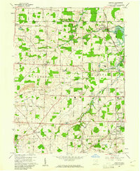
1960 Map of Limaville
USGS Topo · Published 1961About this map
Lexington and Marlboro townships center this 1960s study of the Ohio landscape, revealing a transition from agricultural acreage to early suburban development. The northern section is marked by the Western Reserve boundary, where straight-line road grids like German Church Road and South Boundary Street intersect small hamlets such as New Baltimore. To the southeast, the growing footprint of Alliance is visible, supported by the heavy infrastructure of the Pennsylvania Railroad and the New York Central Railroad.
Find a feature on this map
68 named features on this map. Tap any name to fly to it.
Don’t see what you’re looking for? This feature index may not catch every label — zoom into the map to look around manually.
Map Details
Editions of this 1960 Limaville Map
4 editions found
Other maps of this area

1901 · Canton
USGS Topo · 1:62,500

1903 · Canton
USGS Topo · 1:62,500

1906 · Kent
USGS Topo · 1:62,500

1906 · Ravenna
USGS Topo · 1:62,500

1908 · Ravenna
USGS Topo · 1:62,500

1909 · Alliance
USGS Topo · 1:62,500

1950 · Cleveland
USGS Topo · 1:250,000

1951 · Canton
USGS Topo · 1:250,000

1952 · Alliance
USGS Topo · 1:24,000

1953 · Canton
USGS Topo · 1:250,000