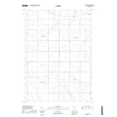
2018 Map of Lime Springs NW
USGS Topo · Published 2018About this map
The Upper Iowa River winds through the northeast corner of this agricultural landscape in northern Howard County, passing just north of the small settlement of Chester. This area is defined by its precise grid of rural township lines, including t100n r13w and t100n r14w, and a network of named roads such as River Rd and Howard Ave. Cultural markers like the Chester Hill Cem offer specific points of interest for those researching local family history or land ownership in this section of Iowa. The terrain is characterized by the drainages of Staff Cr and Beaver Cr, which cut through the level farm plots and dictated the placement of early crossings and homesteads.
Find a feature on this map
30 named features on this map. Tap any name to fly to it.
Don’t see what you’re looking for? This feature index may not catch every label — zoom into the map to look around manually.
Map Details
Editions of this 2018 Lime Springs NW Map
This is the sole edition of this map. No revisions or reprints were ever made.
Other maps of this area

1954 · Mason City
USGS Topo · 1:250,000

1957 · Mason City
USGS Topo · 1:250,000

1958 · Mason City
USGS Topo · 1:250,000

1965 · Le Roy
USGS Topo · 1:24,000

1965 · Ostrander
USGS Topo · 1:24,000

1965 · Cherry Grove
USGS Topo · 1:24,000

1972 · Mc Intire
USGS Topo · 1:24,000

1972 · Riceville
USGS Topo · 1:24,000

1981 · Lourdes
USGS Topo · 1:24,000

1981 · Lime Springs
USGS Topo · 1:24,000