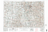
1955 Map of Lincoln
USGS Topo · Published 1982About this map
Lincoln serves as the focal point of this regional study, which illustrates the agricultural and rail network of southeastern Nebraska and northern Kansas. The landscape is defined by the extensive Big Blue River and Little Blue River systems, which supported the development of dozens of small agricultural hubs. Notable for its historical significance, the Homestead National Monument of America appears near Beatrice, marking the site of one of the first land claims under the Homestead Act. The era’s industrial backbone is clearly visible through a dense concentration of rail lines, including the Burlington Northern Railroad, Union Pacific Railroad, and the Missouri Pacific Railroad. Beyond the urban centers of York and Fairbury, the map detail captures the emergence of water management and leisure sites like the Branched Oak Lake State Recreation Area and Pawnee Lake State Recreation Area, reflecting a mid-century transition toward integrated land use and recreation.
Find a feature on this map
186 named features on this map. Tap any name to fly to it.
Don’t see what you’re looking for? This feature index may not catch every label — zoom into the map to look around manually.
Map Details
Editions of this 1955 Lincoln Map
5 editions found

Other maps of this area

1888 · Hiawatha
USGS Topo · 1:125,000

1889 · Seneca
USGS Topo · 1:125,000

1889 · Marysville
USGS Topo · 1:125,000

1892 · Concordia
USGS Topo · 1:125,000

1893 · Washington
USGS Topo · 1:125,000

1893 · Fremont
USGS Topo · 1:125,000

1894 · Seneca
USGS Topo · 1:125,000

1894 · Mankato
USGS Topo · 1:125,000

1894 · Hiawatha
USGS Topo · 1:125,000

1894 · Marysville
USGS Topo · 1:125,000