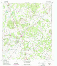
1961 Map of Lincoln
USGS Topo · Published 1989About this map
Middle Yegua Creek and its many tributaries, including Blue Buck Creek and Turkey Creek, define this central Texas landscape during a period of transition. The settlement of Lincoln serves as a local hub near an Old Railroad Grade, while the smaller community of Loebau sits to the east. The map preserves the locations of several community foundations, such as St Johns Sch (Site) and the Loebau Siding (Site), providing essential data for genealogists tracing family roots in Lee County.
Find a feature on this map
43 named features on this map. Tap any name to fly to it.
Don’t see what you’re looking for? This feature index may not catch every label — zoom into the map to look around manually.
Map Details
Editions of this 1961 Lincoln Map
Other maps of this area

1885 · Bastrop
USGS Topo · 1:125,000

1893 · Bastrop
USGS Topo · 1:125,000

1904 · Bastrop
USGS Topo · 1:125,000

1919 · Giddings
USGS Topo · 1:62,500

1919 · Dime Box
USGS Topo · 1:62,500

1948 · Smithville
USGS Topo · 1:62,500

1948 · Lexington
USGS Topo · 1:62,500

1950 · Lexington
USGS Topo · 1:62,500

1950 · Smithville
USGS Topo · 1:62,500

1954 · Austin
USGS Topo · 1:250,000