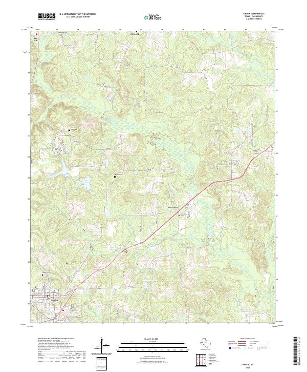
2022 Map of Linden
USGS Topo · Published 2022About this map
The Cass County Courthouse stands as the central landmark of Linden, anchoring a landscape defined by small rural communities and intricate drainage networks in East Texas. The town is surrounded by several satellite settlements, including New Colony, O'Farrell, and Red Hill, each connected by a web of county roads and farm-to-market routes like FM 1841. The local topography is carved by numerous waterways such as Frazier Cr, Bowman Creek, and Colley Cr, which feed into small bodies of water like Price Lake and Harvey Lake.
Find a feature on this map
93 named features on this map. Tap any name to fly to it.
Don’t see what you’re looking for? This feature index may not catch every label — zoom into the map to look around manually.
Map Details
Editions of this 2022 Linden Map
This is the sole edition of this map. No revisions or reprints were ever made.
Other maps of this area

1907 · Atlanta
USGS Topo · 1:62,500

1910 · Linden
USGS Topo · 1:62,500

1910 · Atlanta
USGS Topo · 1:62,500

1944 · Kildare
USGS Topo · 1:62,500

1948 · Kildare
USGS Topo · 1:62,500

1953 · Texarkana
USGS Topo · 1:250,000

1956 · Texarkana
USGS Topo · 1:250,000

1956 · Tyler
USGS Topo · 1:250,000

1961 · Cunningham Creek
USGS Topo · 1:24,000

1962 · Lanier
USGS Topo · 1:24,000