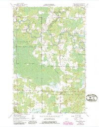
1964 Map of Linden Grove
USGS Topo · Published 1986About this map
The Little Fork River meanders through this portion of St. Louis County, creating a complex drainage network characterized by Durant Rapids and Three Rapids. This mid-century landscape is defined by the intersection of the Sturgeon River State Forest and the Superior National Forest, where timber and wetland management shape the terrain. Small settlements and local landmarks provide a look at rural Minnesota life during the 1960s, notably at the village of Linden Grove and the southern hamlet of Sturgeon.
Find a feature on this map
21 named features on this map. Tap any name to fly to it.
Don’t see what you’re looking for? This feature index may not catch every label — zoom into the map to look around manually.
Map Details
Editions of this 1964 Linden Grove Map
3 editions found
Other maps of this area

1952 · Idington
USGS Topo · 1:24,000

1954 · Hibbing
USGS Topo · 1:250,000

1955 · Dark Lake
USGS Topo · 1:24,000

1955 · Dewey Lake NW
USGS Topo · 1:24,000

1957 · Hibbing
USGS Topo · 1:250,000

1958 · Hibbing
USGS Topo · 1:250,000

1964 · Hibbing
USGS Topo · 1:250,000

1964 · Linden Grove
USGS Topo · 1:24,000

1964 · Haley
USGS Topo · 1:24,000

1964 · Gheen NW
USGS Topo · 1:24,000