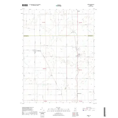
2019 Map of Linden
USGS Topo · Published 2019About this map
The border of Tippecanoe Co Montgomery Co divides this rural landscape, which is centered around the established towns of Linden and New Richmond. The region is defined by a complex network of agricultural drainage infrastructure, including Lofland Ditch, Romney Fraley Ditch, and Dewey Ditch, which channel water toward natural watercourses like the N Fork Coal Cr. This reliance on engineered ditches underscores the transition of the West Central Indiana prairie into high-yield farmland.
Find a feature on this map
46 named features on this map. Tap any name to fly to it.
Don’t see what you’re looking for? This feature index may not catch every label — zoom into the map to look around manually.
Map Details
Editions of this 2019 Linden Map
This is the sole edition of this map. No revisions or reprints were ever made.
Other maps of this area

1953 · Danville
USGS Topo · 1:250,000

1955 · Danville
USGS Topo · 1:250,000

1956 · Danville
USGS Topo · 1:250,000

1956 · Crawfordsville
USGS Topo · 1:24,000

1958 · Darlington
USGS Topo · 1:24,000

1958 · Linden
USGS Topo · 1:24,000

1958 · Kirkpatrick
USGS Topo · 1:24,000

1961 · Romney
USGS Topo · 1:24,000

1961 · Stockwell
USGS Topo · 1:24,000
1962 · Waynetown
USGS Topo · 1:24,000