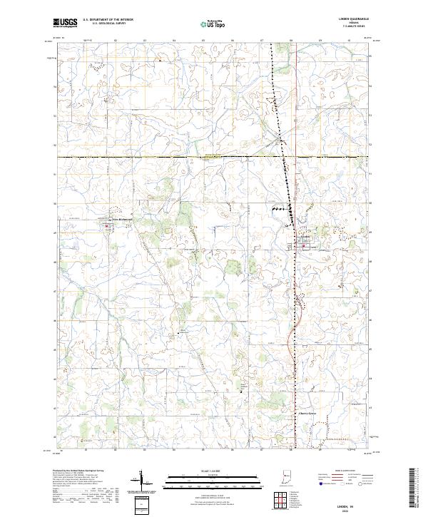
2022 Map of Linden
USGS Topo · Published 2022About this map
Linden and New Richmond sit at the center of this 2022 survey of northern Montgomery County, where the agricultural grid is defined by an intricate network of drainage systems. The landscape is marked by features like Lofland Ditch, Dewey Ditch, and Romney Fraley Ditch, which channel water away from the productive farm fields between the Tippecanoe Co and Montgomery Co line. For genealogists and local historians, the map identifies specific rural landmarks such as Wilson-Killen Cem and Mount Pleasant Cem, located near N Fork Coal Cr. The small community of Cherry Grove anchors the southern portion of the sheet. The layout of local roads, including Base Line RD and N New Richmond Rd, reflects the enduring section-line organization of this Midwestern prairie region.
Find a feature on this map
66 named features on this map. Tap any name to fly to it.
Don’t see what you’re looking for? This feature index may not catch every label — zoom into the map to look around manually.
Map Details
Editions of this 2022 Linden Map
This is the sole edition of this map. No revisions or reprints were ever made.
Other maps of this area

1953 · Danville
USGS Topo · 1:250,000

1955 · Danville
USGS Topo · 1:250,000

1956 · Danville
USGS Topo · 1:250,000

1956 · Crawfordsville
USGS Topo · 1:24,000

1958 · Darlington
USGS Topo · 1:24,000

1958 · Linden
USGS Topo · 1:24,000

1958 · Kirkpatrick
USGS Topo · 1:24,000

1961 · Romney
USGS Topo · 1:24,000

1961 · Stockwell
USGS Topo · 1:24,000
1962 · Waynetown
USGS Topo · 1:24,000