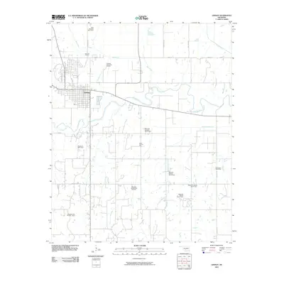
2009 Map of Lindsay
USGS Topo · Published 2009About this map
Lindsay serves as the primary urban center in this Garvin County landscape, positioned northwest of the sweeping curves of the Washita River. The surrounding terrain is defined by a dense network of water management features, including several Maysville Laterals dams such as Maysville Laterals Site H2 Dam and Maysville Laterals Site H7 Dam, alongside various smaller impoundments on Cavel Creek and Happy Hollow Creek.
Find a feature on this map
33 named features on this map. Tap any name to fly to it.
Don’t see what you’re looking for? This feature index may not catch every label — zoom into the map to look around manually.
Map Details
Editions of this 2009 Lindsay Map
This is the sole edition of this map. No revisions or reprints were ever made.
Other maps of this area

1898 · Pauls Valley
USGS Topo · 1:125,000

1902 · Pauls Valley
USGS Topo · 1:125,000

1902 · Rush Springs
USGS Topo · 1:125,000

1957 · Ardmore
USGS Topo · 1:250,000

1963 · Ardmore
USGS Topo · 1:250,000

1965 · Maysville
USGS Topo · 1:24,000
1965 · Stealy
USGS Topo · 1:24,000

1966 · Lindsay
USGS Topo · 1:24,000
1966 · Criner
USGS Topo · 1:24,000

1966 · Lindsay SW
USGS Topo · 1:24,000