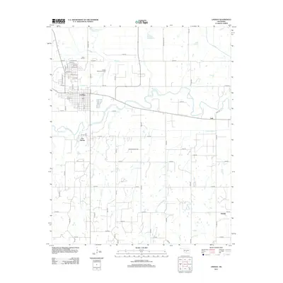
2012 Map of Lindsay
USGS Topo · Published 2012About this map
The Washita River meanders across the central Garvin County landscape, anchoring the regional geography where industrial energy extraction meets rural agriculture. The Golden Trend Oil Field marks the center of the sheet, illustrating the area's continued reliance on petroleum resources. Development centers on the community of Lindsay, which is supported by the Lindsay Municipal Airport and a grid of rural routes like e1500 RD. Smaller settlements and historic locations provide local context for genealogists and historians, including Erin Springs to the south and the smaller locales of Neill and Wallville further east. Vital community landmarks such as Green Hill Hill Cem and Erin Springs Cem are preserved alongside natural drainage systems like Happy Hollow Cr and Bear Cr, which feed into the river valley.
Find a feature on this map
39 named features on this map. Tap any name to fly to it.
Don’t see what you’re looking for? This feature index may not catch every label — zoom into the map to look around manually.
Map Details
Editions of this 2012 Lindsay Map
This is the sole edition of this map. No revisions or reprints were ever made.
Other maps of this area

1898 · Pauls Valley
USGS Topo · 1:125,000

1902 · Pauls Valley
USGS Topo · 1:125,000

1902 · Rush Springs
USGS Topo · 1:125,000

1957 · Ardmore
USGS Topo · 1:250,000

1963 · Ardmore
USGS Topo · 1:250,000

1965 · Maysville
USGS Topo · 1:24,000
1965 · Stealy
USGS Topo · 1:24,000

1966 · Lindsay
USGS Topo · 1:24,000
1966 · Criner
USGS Topo · 1:24,000

1966 · Lindsay SW
USGS Topo · 1:24,000