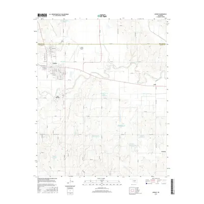
2016 Map of Lindsay
USGS Topo · Published 2016About this map
Lindsay serves as the primary hub of this Garvin County landscape, where the residential street grid gives way to the agricultural and hydraulic systems of the surrounding valley. The Washita River meanders eastward through the center of the sheet, bordered by fertile bottoms and an extensive network of flood control structures, including the Maysville Laterals Site H-34 Reservoir and several related sites. These reservoirs and laterals illustrate the mid-century engineering efforts to manage the river's watershed for local agriculture.
Find a feature on this map
51 named features on this map. Tap any name to fly to it.
Don’t see what you’re looking for? This feature index may not catch every label — zoom into the map to look around manually.
Map Details
Editions of this 2016 Lindsay Map
This is the sole edition of this map. No revisions or reprints were ever made.
Other maps of this area

1898 · Pauls Valley
USGS Topo · 1:125,000

1902 · Pauls Valley
USGS Topo · 1:125,000

1902 · Rush Springs
USGS Topo · 1:125,000

1957 · Ardmore
USGS Topo · 1:250,000

1963 · Ardmore
USGS Topo · 1:250,000

1965 · Maysville
USGS Topo · 1:24,000
1965 · Stealy
USGS Topo · 1:24,000

1966 · Lindsay
USGS Topo · 1:24,000
1966 · Criner
USGS Topo · 1:24,000

1966 · Lindsay SW
USGS Topo · 1:24,000