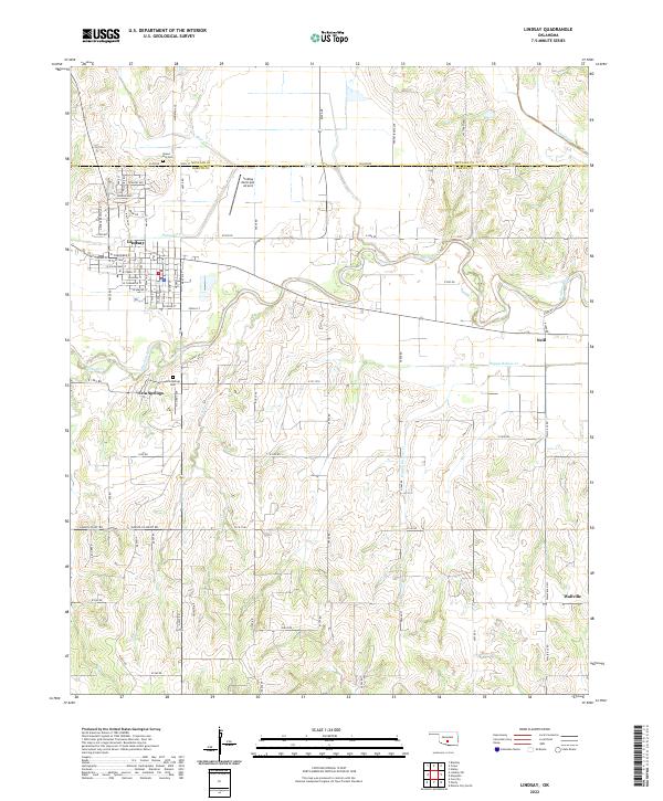
2022 Map of Lindsay
USGS Topo · Published 2022About this map
The Washita River meanders across this Central Oklahoma landscape, defining the character of the river valley near Lindsay. This survey shows the town’s grid expanding south of Bear Cr and Hybarger Cr, while the Lindsay Municipal Airport occupies the northern flats. To the west, Erin Springs sits near the river’s edge, accompanied by its local Erin Springs Cem.
Find a feature on this map
69 named features on this map. Tap any name to fly to it.
Don’t see what you’re looking for? This feature index may not catch every label — zoom into the map to look around manually.
Map Details
Editions of this 2022 Lindsay Map
This is the sole edition of this map. No revisions or reprints were ever made.
Other maps of this area

1898 · Pauls Valley
USGS Topo · 1:125,000

1902 · Pauls Valley
USGS Topo · 1:125,000

1902 · Rush Springs
USGS Topo · 1:125,000

1957 · Ardmore
USGS Topo · 1:250,000

1963 · Ardmore
USGS Topo · 1:250,000

1965 · Maysville
USGS Topo · 1:24,000
1965 · Stealy
USGS Topo · 1:24,000

1966 · Lindsay
USGS Topo · 1:24,000
1966 · Criner
USGS Topo · 1:24,000

1966 · Lindsay SW
USGS Topo · 1:24,000