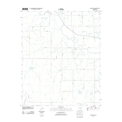
2012 Map of Lindsay SW
USGS Topo · Published 2012About this map
The Washita River meanders across this Central Oklahoma landscape, defining the local hydrology and drainage patterns just southwest of the town of Lindsay. In this agricultural and ranching corridor, water management is evident through a series of numbered flood control structures, including the Bear Hybarger Site 4 Reservoir and multiple catchments along Round Creek Site 9 Reservoir. These features, alongside named tributaries like Larimore Cr and Sandy Cr, illustrate the sophisticated watershed engineering utilized to support the region's rural economy.
Find a feature on this map
48 named features on this map. Tap any name to fly to it.
Don’t see what you’re looking for? This feature index may not catch every label — zoom into the map to look around manually.
Map Details
Editions of this 2012 Lindsay SW Map
This is the sole edition of this map. No revisions or reprints were ever made.
Other maps of this area

1902 · Rush Springs
USGS Topo · 1:125,000

1949 · Rush Springs
USGS Topo · 1:62,500

1950 · Rush Springs
USGS Topo · 1:62,500

1950 · Marlow
USGS Topo · 1:62,500

1951 · Marlow
USGS Topo · 1:62,500

1957 · Ardmore
USGS Topo · 1:250,000

1963 · Ardmore
USGS Topo · 1:250,000

1966 · Lindsay
USGS Topo · 1:24,000
1966 · Criner
USGS Topo · 1:24,000

1966 · Lindsay SW
USGS Topo · 1:24,000