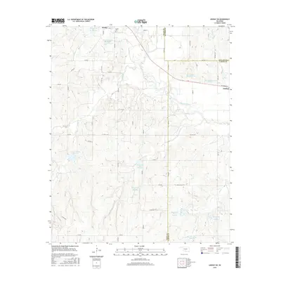
2016 Map of Lindsay SW
USGS Topo · Published 2016About this map
The Washita River meanders through this portion of south-central Oklahoma, defining a landscape shaped by a sophisticated network of flood control and water management. Numerous reservoirs, including the Round Creek Site 4 Reservoir and Bear Hybarger Site 4 Reservoir, dot the terrain between Bradley and the western edge of Lindsay. This concentration of man-made catchments along tributaries like Larimore Cr and Rounds Cr reflects the intensive agricultural and soil conservation efforts prevalent in Garvin, Grady, and McClain counties.
Find a feature on this map
57 named features on this map. Tap any name to fly to it.
Don’t see what you’re looking for? This feature index may not catch every label — zoom into the map to look around manually.
Map Details
Editions of this 2016 Lindsay SW Map
This is the sole edition of this map. No revisions or reprints were ever made.
Other maps of this area

1902 · Rush Springs
USGS Topo · 1:125,000

1949 · Rush Springs
USGS Topo · 1:62,500

1950 · Rush Springs
USGS Topo · 1:62,500

1950 · Marlow
USGS Topo · 1:62,500

1951 · Marlow
USGS Topo · 1:62,500

1957 · Ardmore
USGS Topo · 1:250,000

1963 · Ardmore
USGS Topo · 1:250,000

1966 · Lindsay
USGS Topo · 1:24,000
1966 · Criner
USGS Topo · 1:24,000

1966 · Lindsay SW
USGS Topo · 1:24,000