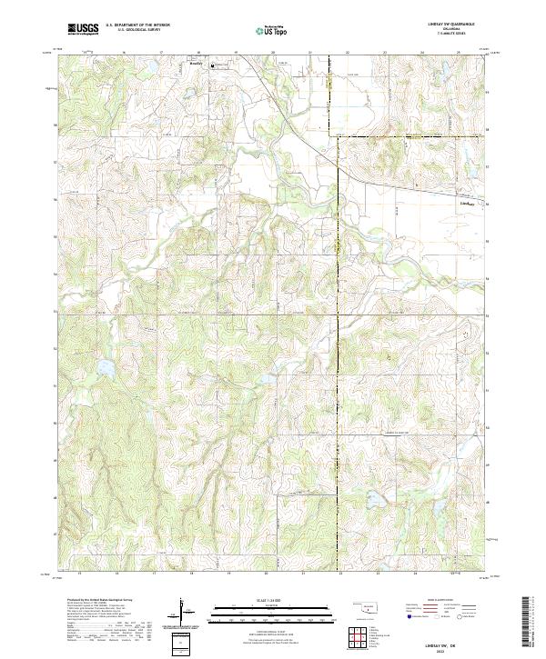
2022 Map of Lindsay SW
USGS Topo · Published 2022About this map
Bradley sits near the northern boundary of this Oklahoma landscape, serving as a primary point of interest for researchers of this tri-county region. The map documents the intricate border intersections where Grady, McClain, and Garvin Counties meet, a geographic complexity that has shaped local land records and property lines for generations. The Washita River meanders through the eastern portion of the quadrangle, joined by numerous drainage systems including Sandy Cr and Larimore Cr, which define the undulating terrain of this agricultural and ranching heartland.
Find a feature on this map
55 named features on this map. Tap any name to fly to it.
Don’t see what you’re looking for? This feature index may not catch every label — zoom into the map to look around manually.
Map Details
Editions of this 2022 Lindsay SW Map
This is the sole edition of this map. No revisions or reprints were ever made.
Other maps of this area

1902 · Rush Springs
USGS Topo · 1:125,000

1949 · Rush Springs
USGS Topo · 1:62,500

1950 · Rush Springs
USGS Topo · 1:62,500

1950 · Marlow
USGS Topo · 1:62,500

1951 · Marlow
USGS Topo · 1:62,500

1957 · Ardmore
USGS Topo · 1:250,000

1963 · Ardmore
USGS Topo · 1:250,000

1966 · Lindsay
USGS Topo · 1:24,000
1966 · Criner
USGS Topo · 1:24,000

1966 · Lindsay SW
USGS Topo · 1:24,000