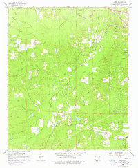
1962 Map of Lisbon
USGS Topo · Published 1978About this map
The southern Arkansas timberlands and industrial fields of Van Buren and Washington townships are revealed in this 1960s-era survey. The local economy is defined by the extensive Bear Creek Oil and Gas Field and the Lisbon Oil and Gas Field, with numerous wells and access roads cutting through the wooded landscape. The small settlement of Lisbon serves as a central hub, while Dumas City appears in the southeast.
Find a feature on this map
23 named features on this map. Tap any name to fly to it.
Don’t see what you’re looking for? This feature index may not catch every label — zoom into the map to look around manually.
Map Details
Editions of this 1962 Lisbon Map
3 editions found
Other maps of this area

1927 · El Dorado
USGS Topo · 1:62,500

1930 · El Dorado
USGS Topo · 1:62,500

1951 · El Dorado
USGS Topo · 1:62,500

1953 · El Dorado
USGS Topo · 1:250,000

1957 · El Dorado
USGS Topo · 1:250,000

1958 · El Dorado
USGS Topo · 1:250,000

1960 · El Dorado
USGS Topo · 1:250,000

1962 · Lisbon
USGS Topo · 1:24,000

1962 · Louann
USGS Topo · 1:24,000

1962 · Buena Vista
USGS Topo · 1:24,000