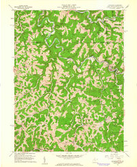
1960 Map of Littleton
USGS Topo · Published 1962About this map
Fish Creek carves a winding path through this corner of Wetzel County, shaping a landscape defined by deep runs and prominent ridgelines like Rocky Ridge and Kirk Ridge. The 1960 field check reveals a region heavily marked by the energy industry, with hundreds of gas and oil wells dotting the hillsides from Amos down to Uniontown. The Baltimore and Ohio RR follows the creek's curve through the valley, serving the town of Littleton and smaller stations like Denver Heights. This era shows a distributed rural community anchored by numerous country churches, including Meadowdale Ch, Morris Run Ch, and the high-elevation Robinson Ridge Ch. Genealogists will find many family-named landmarks and cemeteries, such as Mount Zion Cem and Strosnider Hill, which preserve the names of the families who settled these narrow valleys and ridges before the mid-century industrial footprint expanded.
Find a feature on this map
61 named features on this map. Tap any name to fly to it.
Don’t see what you’re looking for? This feature index may not catch every label — zoom into the map to look around manually.
Map Details
Editions of this 1960 Littleton Map
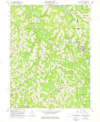
2 editions found
Other maps of this area

1903 · Littleton
USGS Topo · 1:62,500

1904 · Cameron
USGS Topo · 1:62,500

1905 · Mannington
USGS Topo · 1:62,500

1905 · Rogersville
USGS Topo · 1:62,500

1905 · Littleton
USGS Topo · 1:62,500

1923 · Mannington
USGS Topo · 1:62,500

1924 · Littleton
USGS Topo · 1:62,500

1926 · Littleton
USGS Topo · 1:62,500

1926 · Mannington
USGS Topo · 1:62,500

1935 · Cameron
USGS Topo · 1:62,500