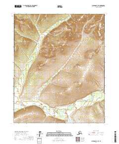
2017 Map of Livengood B-1 NE
USGS Topo · Published 2017About this map
Beaver Creek and Nome Creek converge in the southern portion of this landscape, marking a significant drainage junction in the Yukon-Koyukuk region. The area is defined by its water systems and elevation changes, with O'Brien Cr and Roy Cr threading through the northern townships. The topographic character of the region reflects a remote and undeveloped Alaskan interior, where the primary landmarks are the natural watercourses that have historically dictated travel and access through this part of the interior. This 2017 study illustrates the complex drainage patterns and terrain without the presence of established roads or settlements, focusing instead on the hydrography that defines the land within the boundaries of T7N R3E and its neighboring townships.
Find a feature on this map
13 named features on this map. Tap any name to fly to it.
Don’t see what you’re looking for? This feature index may not catch every label — zoom into the map to look around manually.
Map Details
Editions of this 2017 Livengood B-1 NE Map
This is the sole edition of this map. No revisions or reprints were ever made.
Other maps of this area

1945 · Livengood
USGS Topo · 1:250,000

1951 · Livengood
USGS Topo · 1:250,000

1951 · Circle
USGS Topo · 1:250,000

1951 · Livengood C-1
USGS Topo · 1:63,360

1951 · Circle C-6
USGS Topo · 1:63,360

1954 · Circle B-6
USGS Topo · 1:63,360

1954 · Livengood C-1
USGS Topo · 1:63,360
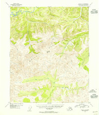
1954 · Circle C-6
USGS Topo · 1:63,360

1954 · Livengood B-1
USGS Topo · 1:63,360

1955 · Circle
USGS Topo · 1:250,000