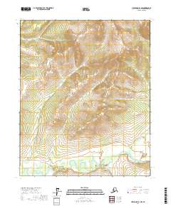
2017 Map of Livengood B-1 NW
USGS Topo · Published 2017About this map
Beaver Creek flows through the southern section of this Interior Alaska landscape, set within the Yukon-Koyukuk Census Area. This region is defined by its drainage network, where Brigham Cr and O'Brien Cr carve through the high elevations of the Livengood region. The map illustrates a wilderness dominated by topographical relief and watercourses, with Trail Cr feeding into the larger river system near the southern boundary.
Find a feature on this map
10 named features on this map. Tap any name to fly to it.
Don’t see what you’re looking for? This feature index may not catch every label — zoom into the map to look around manually.
Map Details
Editions of this 2017 Livengood B-1 NW Map
This is the sole edition of this map. No revisions or reprints were ever made.
Other maps of this area

1945 · Livengood
USGS Topo · 1:250,000

1951 · Livengood
USGS Topo · 1:250,000

1951 · Livengood C-2
USGS Topo · 1:63,360

1951 · Livengood C-1
USGS Topo · 1:63,360

1951 · Livengood B-2
USGS Topo · 1:63,360

1954 · Livengood C-2
USGS Topo · 1:63,360

1954 · Livengood C-1
USGS Topo · 1:63,360
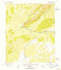
1954 · Livengood B-2
USGS Topo · 1:63,360

1954 · Livengood B-1
USGS Topo · 1:63,360

1956 · Livengood
USGS Topo · 1:250,000