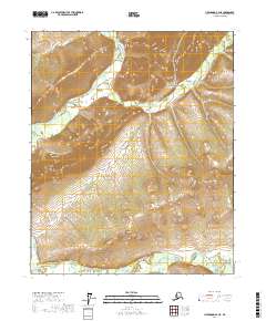
2017 Map of Livengood B-2 NE
USGS Topo · Published 2017About this map
The White Mountains dominate this interior Alaskan landscape, characterized by significant elevation changes and a dense network of subarctic drainage systems. The survey area is defined by the winding course of Beaver Creek, which cuts through the terrain in the northern and southern sections of the quadrangle. Local topography is further articulated by steep-walled features such as Limestone Gulch and several tributary streams including Fossil Cr and Montana Cr.
Find a feature on this map
12 named features on this map. Tap any name to fly to it.
Don’t see what you’re looking for? This feature index may not catch every label — zoom into the map to look around manually.
Map Details
Editions of this 2017 Livengood B-2 NE Map
This is the sole edition of this map. No revisions or reprints were ever made.
Other maps of this area

1945 · Livengood
USGS Topo · 1:250,000

1951 · Livengood
USGS Topo · 1:250,000

1951 · Livengood C-2
USGS Topo · 1:63,360

1951 · Livengood C-1
USGS Topo · 1:63,360

1951 · Livengood B-2
USGS Topo · 1:63,360

1954 · Livengood C-2
USGS Topo · 1:63,360

1954 · Livengood C-1
USGS Topo · 1:63,360
1954 · Livengood B-2
USGS Topo · 1:63,360

1954 · Livengood B-1
USGS Topo · 1:63,360

1956 · Livengood
USGS Topo · 1:250,000