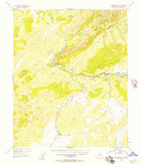
1954 Map of Livengood B-2
USGS Topo · Published 1958About this map
The White Mountains dominate this mid-century Alaskan interior landscape, where the meandering Beaver Creek carves a deep valley through the limestone and dolomite peaks. Surveyed shortly after the war, the map reveals a remote territory accessible primarily by air and water, marked by a single Airstrip and scattered wilderness structures labeled simply as Cabin. These small outposts along the riverbanks suggest the persistent presence of trapping or prospecting during the early 1950s. To the south, Wickersham Creek and Moose Creek drain the high country, including the prominent survey point at VABM 3218 Scham. The intricate network of seasonal drainages, such as Fossil Creek and Montana Creek, provides a detailed look at the hydrology of the Yukon-Koyukuk region before more modern infrastructure reached this part of the bush.
Find a feature on this map
14 named features on this map. Tap any name to fly to it.
Don’t see what you’re looking for? This feature index may not catch every label — zoom into the map to look around manually.
Map Details
Editions of this 1954 Livengood B-2 Map
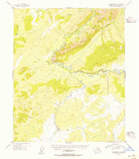
2 editions found
Other maps of this area

1945 · Livengood
USGS Topo · 1:250,000

1951 · Livengood
USGS Topo · 1:250,000

1951 · Livengood C-2
USGS Topo · 1:63,360

1951 · Livengood C-1
USGS Topo · 1:63,360

1951 · Livengood B-2
USGS Topo · 1:63,360

1952 · Livengood A-2
USGS Topo · 1:63,360

1952 · Livengood A-1
USGS Topo · 1:63,360

1953 · Livengood A-3
USGS Topo · 1:63,360

1954 · Livengood C-2
USGS Topo · 1:63,360

1954 · Livengood C-1
USGS Topo · 1:63,360