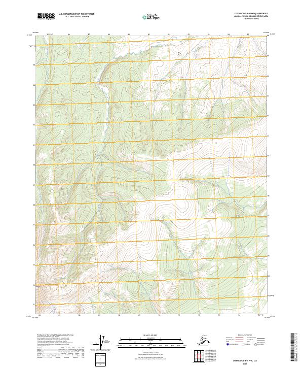
2024 Map of Livengood B-5 NW
USGS Topo · Published 2024About this map
Sawtooth Mtn defines the southern reaches of this interior Alaskan landscape, anchoring a wilderness of complex drainage patterns and high-latitude terrain. The hydrography is dominated by the Mud Fork, which meanders through the central valley, and Huron Creek in the northwest. This U.S. Geological Survey representation highlights the raw topography of the Yukon-Koyukuk region, revealing a landscape without established roads or settlements. The map illustrates the fundamental natural barriers and watercourses that have historically dictated travel and survival in this portion of the Alaskan interior, providing an essential record for those studying the physical geography of the remote north.
Find a feature on this map
9 named features on this map. Tap any name to fly to it.
Don’t see what you’re looking for? This feature index may not catch every label — zoom into the map to look around manually.
Map Details
Editions of this 2024 Livengood B-5 NW Map
This is the sole edition of this map. No revisions or reprints were ever made.
Other maps of this area

1945 · Livengood
USGS Topo · 1:250,000

1951 · Livengood
USGS Topo · 1:250,000

1952 · Livengood C-5
USGS Topo · 1:63,360

1952 · Livengood B-5
USGS Topo · 1:63,360

1956 · Livengood B-6
USGS Topo · 1:63,360

1956 · Livengood C-6
USGS Topo · 1:63,360

1956 · Livengood
USGS Topo · 1:250,000

1964 · Livengood
USGS Topo · 1:250,000
2017 · Livengood B-5 SW
USGS Topo · 1:25,000
2017 · Livengood B-5 SE
USGS Topo · 1:25,000