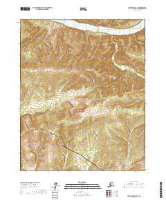
2017 Map of Livengood D-5 SW
USGS Topo · Published 2017About this map
The Yukon River defines the northern reaches of this landscape, where the water flows westward past the high interior terrain. This specific stretch is characterized by the convergence of critical modern infrastructure, as the Alaska Pipeline and the Dalton Highway both traverse the hills south of the river. These engineering corridors parallel one another through the townships of t11n r9w and t12n r9w, navigating the drainage basins of several small tributaries. Notable drainages include Isom Cr and Rock Cr, which cut through the steep topography before their waters eventually join the Yukon. The map provides a clear look at the elevation patterns and the sparse, utilitarian network of roads and pipelines that support the resource-rich interior of the Yukon-Koyukuk region during the early 21st century.
Find a feature on this map
10 named features on this map. Tap any name to fly to it.
Don’t see what you’re looking for? This feature index may not catch every label — zoom into the map to look around manually.
Map Details
Editions of this 2017 Livengood D-5 SW Map
This is the sole edition of this map. No revisions or reprints were ever made.
Other maps of this area

1945 · Livengood
USGS Topo · 1:250,000

1951 · Livengood
USGS Topo · 1:250,000

1952 · Livengood C-5
USGS Topo · 1:63,360

1952 · Livengood D-5
USGS Topo · 1:63,360

1956 · Livengood C-6
USGS Topo · 1:63,360

1956 · Livengood D-6
USGS Topo · 1:63,360

1956 · Livengood
USGS Topo · 1:250,000

1964 · Livengood
USGS Topo · 1:250,000
2017 · Livengood C-5 NW
USGS Topo · 1:25,000
2017 · Livengood C-5 NE
USGS Topo · 1:25,000