
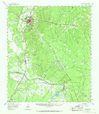
1958 Map of Livingston
USGS Topo · Published 1960About this map
Livingston serves as the focal point of this East Texas survey, situated at the intersection of significant rail and petroleum infrastructure in the late 1950s. The regional economy is clearly defined by the Livingston Oil Field and Morgan Creek Oil Field, alongside the Texas and New Orleans RR and the Southern Pacific lines. These transport routes parallel the Trinity River, which carves the southern boundary between Polk and San Jacinto counties.
Find a feature on this map
65 named features on this map. Tap any name to fly to it.
Don’t see what you’re looking for? This feature index may not catch every label — zoom into the map to look around manually.
Map Details
Editions of this 1958 Livingston Map
2 editions found
Other maps of this area

1943 · Liberty
USGS Topo · 1:125,000

1954 · Beaumont
USGS Topo · 1:250,000

1955 · Saratoga
USGS Topo · 1:62,500

1955 · Camden
USGS Topo · 1:62,500

1955 · Rayburn
USGS Topo · 1:62,500

1955 · New Willard
USGS Topo · 1:62,500

1957 · Beaumont
USGS Topo · 1:250,000

1958 · Westcott
USGS Topo · 1:24,000

1958 · Segno
USGS Topo · 1:62,500

1960 · Blanchard
USGS Topo · 1:24,000