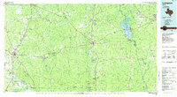
1985 Map of Livingston
USGS Topo · Published 1985About this map
The Alabama and Coushatta Indian Reservation serves as a central cultural landmark in this mid-1980s portrait of East Texas. Bordered by the Neches River and Trinity River systems, the landscape is defined by the dense woodlands of the Big Thicket National Preserve and the John H Kirby State Forest. Industrial and community life is visible through the Livingston Oil Field and scattered timber settlements like Camden and Barnum.
Find a feature on this map
157 named features on this map. Tap any name to fly to it.
Don’t see what you’re looking for? This feature index may not catch every label — zoom into the map to look around manually.
Map Details
Editions of this 1985 Livingston Map
This is the sole edition of this map. No revisions or reprints were ever made.
Other maps of this area

1927 · Lufkin 4-c
USGS Topo · 1:24,000

1928 · Zavalla 3-c
USGS Topo · 1:24,000

1928 · Lufkin 4-d
USGS Topo · 1:24,000

1931 · Zavalla
USGS Topo · 1:62,500

1932 · Manning
USGS Topo · 1:62,500

1943 · Liberty
USGS Topo · 1:125,000

1952 · Lake Charles
USGS Topo · 1:250,000

1953 · Alexandria
USGS Topo · 1:250,000

1953 · Palestine
USGS Topo · 1:250,000

1954 · Lake Charles
USGS Topo · 1:250,000