
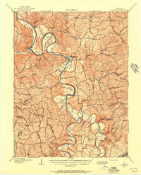
1906 Map of Lockport
USGS Topo · Published 1906About this map
The Kentucky River carves a winding path through this 1906 survey, defining the agricultural and industrial character of the valley. The river’s vital role in transportation and early infrastructure is evident at Lock & Dam No 2 and Lock & Dam No 1, which facilitated commercial movement through the deep river bottoms. These fertile lowlands, including Clements Bottom, Browns Bottom, and Nardins Bottom, were the anchors of local settlement in Owen, Franklin, and Henry Counties. Away from the water’s edge, the map records the locations of rural community centers like Pleasant Home Church and Bethel Church. The inclusion of Manfords Ferry shows a landscape still reliant on traditional river crossings, while names like Swallowfield and Peaks Mill provide a detailed look at the scattered hamlets and family-named landmarks of the early twentieth century.
Find a feature on this map
21 named features on this map. Tap any name to fly to it.
Don’t see what you’re looking for? This feature index may not catch every label — zoom into the map to look around manually.
Map Details
Editions of this 1906 Lockport Map
2 editions found
Other maps of this area

1906 · Georgetown
USGS Topo · 1:62,500

1908 · Lockport
USGS Topo · 1:62,500

1908 · Georgetown
USGS Topo · 1:62,500

1922 · Frankfort
USGS Topo · 1:48,000

1923 · Waddy
USGS Topo · 1:48,000

1924 · Frankfort
USGS Topo · 1:62,500

1925 · Mount Eden
USGS Topo · 1:48,000

1927 · Mount Eden
USGS Topo · 1:62,500

1928 · New Castle
USGS Topo · 1:48,000

1932 · New Castle
USGS Topo · 1:62,500