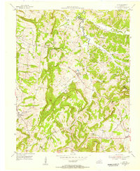
1954 Map of Lola
USGS Topo · Published 1955About this map
Lola and Hampton serve as the primary nodes of settlement in this mid-century portrait of the Kentucky landscape. The area is defined by a dense network of country institutions, including Bethel Ch, Hopewell Ch, and Old Salem Ch, which anchored the rural communities of Livingston and Crittenden counties. Educational centers such as Oak Grove Sch and Threlkeld Sch are spaced across the terrain, reflecting the localized social structure of the era.
Find a feature on this map
39 named features on this map. Tap any name to fly to it.
Don’t see what you’re looking for? This feature index may not catch every label — zoom into the map to look around manually.
Map Details
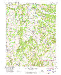
Editions of this 1954 Lola Map
2 editions found
Other maps of this area

1916 · Fords Ferry
USGS Topo · 1:62,500

1916 · Golconda
USGS Topo · 1:62,500

1920 · Goloonda
USGS Topo · 1:48,000

1921 · Fords Ferry
USGS Topo · 1:48,000

1921 · Golconda
USGS Topo · 1:62,500

1925 · Cave In Rock
USGS Topo · 1:62,500

1928 · Eddyville
USGS Topo · 1:48,000

1929 · Smithland
USGS Topo · 1:62,500

1931 · Eddyville
USGS Topo · 1:62,500

1936 · Eddyville
USGS Topo · 1:48,000