2017 Map of Lone Butte NE
USGS Topo · Published 2017About this map
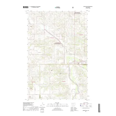
The Little Missouri River meanders through this portion of the Badlands, creating a deeply eroded landscape within the Little Missouri National Grassland. This 2017 survey shows the intersection of the McKenzie Co and Dunn Co boundary line amidst a network of drainage creeks including Cherry Cr, Elkhorn Cr, and Rough Cr. Distinctive landforms such as Haystack Butte and Round Top Butte provide prominent vertical relief in an area primarily defined by public grazing lands and section-line access roads like 118th Ave NW. The map illustrates the contemporary balance between protected federal lands and the rural infrastructure of western North Dakota, where the topography of the Lmng dictates the placement of winding trails and seasonal waterways.
Find a feature on this map
19 named features on this map. Tap any name to fly to it.
Don’t see what you’re looking for? This feature index may not catch every label — zoom into the map to look around manually.
Map Details
Editions of this 2017 Lone Butte NE Map
This is the sole edition of this map. No revisions or reprints were ever made.
Other maps of this area

1953 · Watford City
USGS Topo · 1:250,000

1957 · Watford City
USGS Topo · 1:250,000

1958 · Lone Butte SE
USGS Topo · 1:24,000

1958 · Lone Butte
USGS Topo · 1:24,000

1958 · North Killdeer Mountain
USGS Topo · 1:24,000

1959 · Lone Butte NW
USGS Topo · 1:24,000

1959 · Croff
USGS Topo · 1:24,000

1959 · Lone Butte NE
USGS Topo · 1:24,000

1965 · Johnsons Corner
USGS Topo · 1:24,000

1967 · Watford City
USGS Topo · 1:250,000