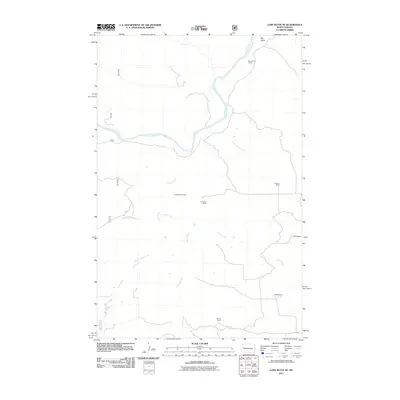
2011 Map of Lone Butte SE
USGS Topo · Published 2011About this map
The Little Missouri River carves through this remote stretch of McKenzie County, defining a landscape shaped by both cattle ranching and energy extraction. The map reveals the sprawling reaches of the Lone Butte Oil Field, indicating the intersection of industrial development and traditional land use. Family-named outposts such as Monroe Ranch, Erickson Ranch, and Odenthal Ranch appear as focal points of human activity amidst a complex network of drainages. Numerous seasonal waterways, including Crosby Creek, Cottonwood Creek, and Sand Creek, feed toward the river valley, cutting through terrain marked by features like Big Gulch. This survey captures the rural infrastructure of the early 21st century, where section lines and local roads like 6th St NW provide access to the various ranch holdings and oil production sites dotting the plains.
Find a feature on this map
17 named features on this map. Tap any name to fly to it.
Don’t see what you’re looking for? This feature index may not catch every label — zoom into the map to look around manually.
Map Details
Editions of this 2011 Lone Butte SE Map
This is the sole edition of this map. No revisions or reprints were ever made.
Other maps of this area

1953 · Watford City
USGS Topo · 1:250,000

1957 · Watford City
USGS Topo · 1:250,000

1958 · Lone Butte SE
USGS Topo · 1:24,000

1958 · Lone Butte
USGS Topo · 1:24,000

1958 · North Killdeer Mountain
USGS Topo · 1:24,000

1959 · Lone Butte NW
USGS Topo · 1:24,000

1959 · Croff
USGS Topo · 1:24,000

1959 · Lone Butte NE
USGS Topo · 1:24,000

1967 · Watford City
USGS Topo · 1:250,000

1974 · Killdeer
USGS Topo · 1:100,000