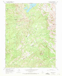
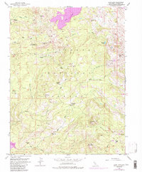
1952 Map of Loon Lake
USGS Topo · Published 1971About this map
Loon Lake and the high country of the El Dorado National Forest are defined by an intricate network of waterways and early mountain outposts in this mid-century survey. The landscape is dotted with historical cattle and ranching sites like Francis Cow Camp, Van Vleck Ranch, and the Upper Bassi Ranch, reflecting the area's grazing history. Water resources are central to the terrain, featuring the Rubicon River, the South Fork Rubicon River, and high-altitude basins such as Rocky Basin and Wench Flat. High peaks and ridges like Tells Peak and Two Peaks overlook a series of smaller lakes, including Berts Lake and Forni Lake. The presence of several primitive Jeep Trails, the Highland Trail, and a private Landing Strip indicates the area's role as a transition point between early resource extraction and the emerging post-war recreation era, as backcountry cabins like the Rupley Cabin and Stone Cellar became more accessible.
Find a feature on this map
40 named features on this map. Tap any name to fly to it.
Don’t see what you’re looking for? This feature index may not catch every label — zoom into the map to look around manually.
Map Details
Editions of this 1952 Loon Lake Map
6 editions found
Other maps of this area

1889 · Pyramid Peak
USGS Topo · 1:125,000

1891 · Truckee
USGS Topo · 1:125,000

1891 · Pyramid Peak
USGS Topo · 1:125,000

1893 · Truckee
USGS Topo · 1:125,000

1895 · Pyramid Peak
USGS Topo · 1:125,000

1895 · Truckee
USGS Topo · 1:125,000

1896 · Pyramid Peak
USGS Topo · 1:125,000

1932 · Truckee
USGS Topo · 1:96,000

1940 · Truckee
USGS Topo · 1:125,000

1947 · Sacramento
USGS Topo · 1:250,000