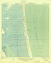
1923 Map of Lopena Island
USGS Topo · Published 1946About this map
Padre Island stretches along the Texas coastline in this early twentieth-century survey, separating the shallow, patterned waters of the Laguna Madre from the open Gulf of Mexico. The landscape is dominated by the dynamic barrier island system, showing the intricate network of sandbars and tidal flats that defined the Kenedy County shore before modern development. Inland, the map identifies the early footprint of regional cattle operations, specifically the Saltillo Ranch and Turida Ranch. These labels provide a record of land use and family holdings in a period when the barrier islands remained largely wild and the coastal economy centered on large-scale ranching. The inclusion of Lopeña Island within the lagoon highlights the specific navigational and geological features surveyed by the U.S. Coast and Geodetic Survey years before the mid-century reprinting.
Find a feature on this map
6 named features on this map. Tap any name to fly to it.
Don’t see what you’re looking for? This feature index may not catch every label — zoom into the map to look around manually.
Map Details
Editions of this 1923 Lopena Island Map
2 editions found
Other maps of this area

1921 · Tarida Ranch
USGS Topo · 1:62,500

1923 · Lopena Island
USGS Topo · 1:62,500

1923 · Saltillo Ranch
USGS Topo · 1:62,500

1928 · Sarita
USGS Topo · 1:125,000

1950 · Corpus Christi
USGS Topo · 1:250,000

1951 · South of Potrero Lopeno NE
USGS Topo · 1:24,000

1951 · Potrero Lopeno NW
USGS Topo · 1:24,000

1952 · Potrero Lopeno SE
USGS Topo · 1:24,000

1952 · Potrero Cortado
USGS Topo · 1:24,000

1952 · South of Potrero Lopeno NW
USGS Topo · 1:24,000